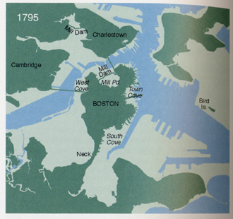
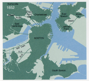
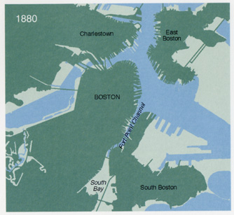
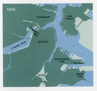
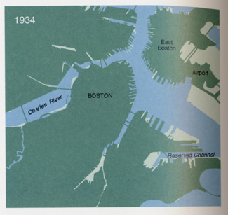
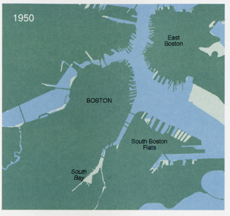
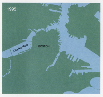
| The
following set of 8 diagrams show the changing shapes of Boston
and the Charles River basin over the last four centuries.
The diagrams were prepared by The Muriel G. and Norman B.
Leventhal Family Foundation; cartography by MapWorks, Herb
Heidt and Eliza McClemen. They are reproduced in Karl Haglund,
Inventing the Charles River (Cambridge: MIT Press, 2003),
460-3.
|