| Any tourist
visiting Boston quickly learns the crucial role that the Hub
played in the American Revolution. Bostonians set the pace
of the rebellion from the Stamp Act protests in 1765, through
the Boston Massacre in 1770, the Tea Party in 1773 and the
Battle of Bunker Hill in 1775. Many leaders of the Continental
Congress hailed from Boston, as did several influential newspaper
publishers, pamphleteers, merchants and ministers.
But the history of the American Revolution in Boston extends
beyond these human actors to the landscape of the city itself.
Boston's position as a natural harbor for New England gave
rise to its commercial prosperity and strong merchant class,
and also placed it at the center of struggles to negotiate
the boundaries of imperial trade policy. Boston's shape as
a peninsula attached to the mainland by a thin strip of land
at the Neck made it an easy town for the British Regulars
to occupy and fortify.
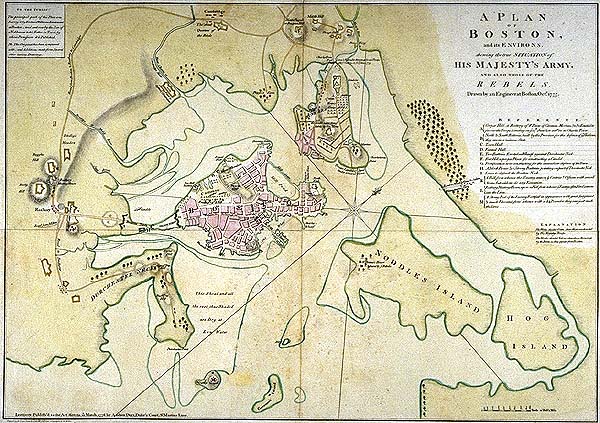
The map
above, drawn by Richard Williams in 1776, is one of many
that depict Boston and the surrounding areas and waterways
during the American Revolution. This map emphasizes the vast
size of the harbor that seems to almost entirely circle Boston.
The Charles River in the upper right hand corner of the map
appears a tiny detail. The rest of this page examines some
of the ways that the water around Boston impacted the Revolution
by looking at the Boston harbor, Paul Revere's crossing the
Charles to begin his famous ride, and the Siege of Boston
in 1775 and 1776.
Harboring the Revolution
Revere's River Ride
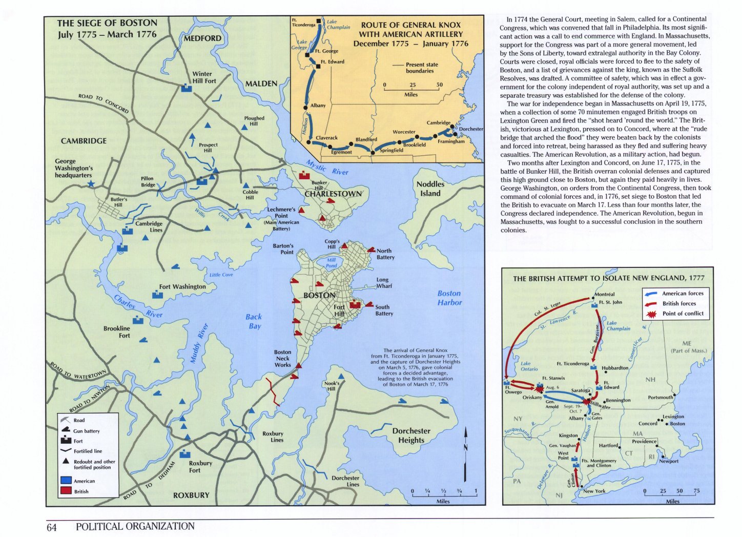
The Siege across the River
The Charles River affected military strategy during the Siege
of Boston. The location of the river created a natural boundary
between the British soldiers besieged inside Boston, and the
Americans surrounding them at camps in Cambridge and Roxbury.
In the winter of 1775/6, the Americans considered a plan to
attack the city by marching soldiers across the ice. So too,
they constantly worried that the British might attack them.
The shape of the river mattered too. The Charles was not deep
enough for the British fleet to sail up, which kept the American
camps out of the range of British bombardment. The most famous
battle of the Siege of Boston was the Battle of Bunker Hill
on June 17, 1775, when the British Regulars crossed the Charles
from Boston to attack American positions in Charlestown. But
there was other fighting before and after then all around
the River.
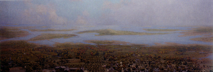
- The Widener Library Diorama
looking out over the river from Cambridge in 1775 during
the Siege.
- This 1775 map shows some fortifications and the positions
of the armies during the Siege of Boston when Washington
took command. "A
Draught of the Towns of Boston & Charlestown" drawn
by John Montresor, 1775. From the Clinton Collection
of the Clements Library of the University of Michigan.
- Compare it to a modern,
schematic view of the positions of the armies during the
Siege of Boston in 1775. It is from Richard W. Wilkie
and Jack Trager, Historical Atlas of Massachusetts
(1991).
- A diary entry from Private Amos
Farnsworth about fighting in May, 1775 over harbor islands
at the mouth of the Charles River.
- "View of The Attack
on Bunker's Hill, with the Burning of Charles Town, June
17, 1775.
Copy of engraving by Lodge after Millar, circa 1775-80."
- The Massachusetts
Historical Society's virtual display on the Battle of Bunker
Hill
- A
Worcester Polytechnic Institute ROTC military analysis of
The Battle of Bunker Hill
- A Letter from Abby Adams to John
Adams, Braintree, November 12, 1775 about fighting along
the Charles River.
|