Shaping The Environment:
|
| The Charles River begins in Hopkinton, Massachusetts and zig-zags eighty miles from there to Boston. In comparison, the Boston marathon covers the route from Hopkinton to Boston in just over 26 miles. The Charles is, for most of this distance, a rather small stream, with a slow meandering flow. While it is the longest river entirely within Massachusetts, it is much smaller and slower than other New England Rivers like the Connecticut, Merrimack or Blackstone. Nonetheless, because of its important location, for more than three hundred years, New Englanders have sought to represent, harness, cross, and shape the Charles River. Mapping the Charles:
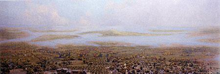
One of the easiest ways for humans to invent an object is to create a representation of it. Photographs, literary texts, and diagrams are different media that humans use to represent things around them. Maps are a medium used to represent a physical space. Before Europeans bridged the Charles, or shaped the river in other ways, they mapped it. While the first maps of the Charles date back to the early seventeenth century, modern artists, photographers and geographers have devised more complex ways of representing the river. One example of this is the set of dioramas of Harvard College and its environment on the first floor of Widener library. The diorama from 1775 is pictured above. The links in the following list take you to a series of images in the slide carousel for HSB41. As you look at them, think about choices these map-makers made in how they represent the Charles. Do the maps focus on just Boston, or more of the Massachusetts hinterland? Are buildings shown? Military positions? Economic sites? What about other natural landmarks? Political boundaries? Ecological or geological information? What kinds of objects are named on the maps, and what names are they given?
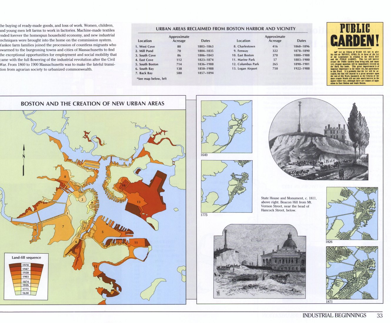
Moving the Charles:In part, the differences between these maps reveal a change in how people wanted to represent the river. Yet the physical shape of the river itself has changed dramatically over the last four centuries. This set of eight diagrams shows how Boston has expanded to fill the Charles. As these diagrams show, much of this project took place in the late nineteenth century, but it continues today. This single map from Richard W. Wilkie and Jack Tager's The Historical Atlas of Massachusetts (1991) offers another view of the changing shape of Boston and the Charles.
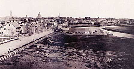
As this 1878 image of the Charles River along Mount Auburn
street in Cambridge suggests, until the Metropolitan Park
System was created in 1893, the last nine miles of the Charles
River (from Watertown to Boston Harbor) was still a tidal
estuary. Concerns about polution and sewage led to a plan
to dam the river's mouth and create the fresh water Charles
River Basin. The construction of the dam was completed in
1910, and the new banks of the river landscaped into the esplanade
shortly after that. In the years since, often in conjunction
with transportation projects like the building of Storrow
Drive and the Big Dig, the parks along both sides of the Charles
have been expanded and moved. Crossing the Charles:New Englanders have devised many ways to cross the Charles, from the first regular ferry service between Charlestown and Boston in 1631 through today's elegant and expensive Leonard Zakim Bunker Hill Bridge. 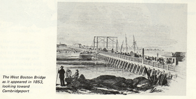
|